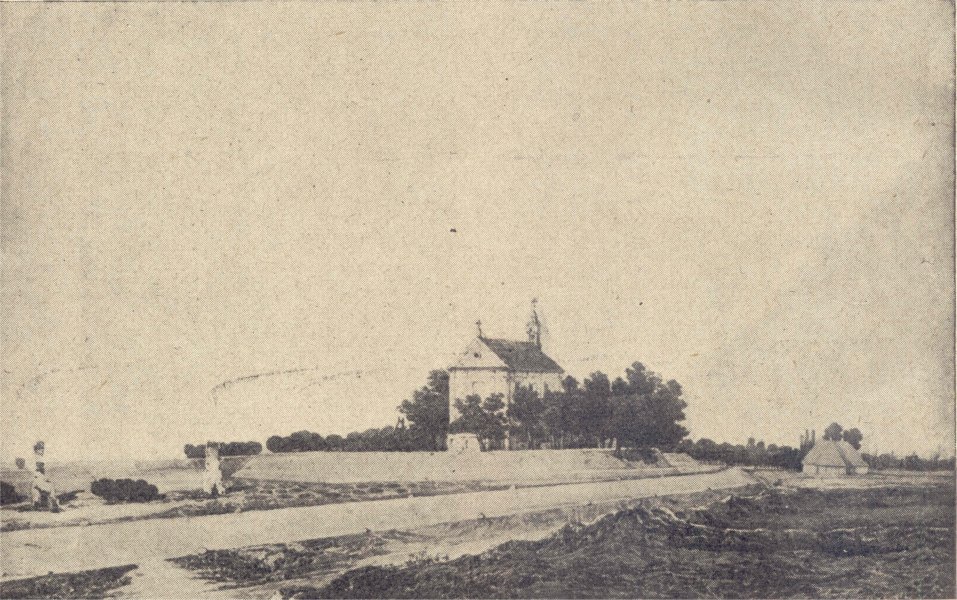
Saint Lawrence church
History of Wola district until 1st September 1939.
Name of district - Wola correspond to the name of village that was called Wielka Wola Warszawska (lat. Magna Wola Varsoviensis ) owned by prince, also seat of parish, village was mentioned in chronicles since second half of thirteenth century. There were two routes from Warsaw that were cutting Wola (into western direction): first one on current Dluga, Leszno and Górczewska street, the other one on Senatorska, Elektoralna and Chlodna street. This fact had big influence on Wola development and growth.
Since fourteenth century Wielka Wola became part of Warsaw starosty. Village buildings were mostly concentrated along the route, between current Elekcyjna and Sowinskiego street. In the middle of the village were st. Stanislaw the Bishop and Martyr of Parish st. Wojciech church (Kosciol sw. Stanislawa Biskupa i Meczennika parafii sw. Wojciecha),and st. Lawrence church (sw. Wawrzynca) which fates were strongly bounded with Wola ones.
Saint Lawrence church
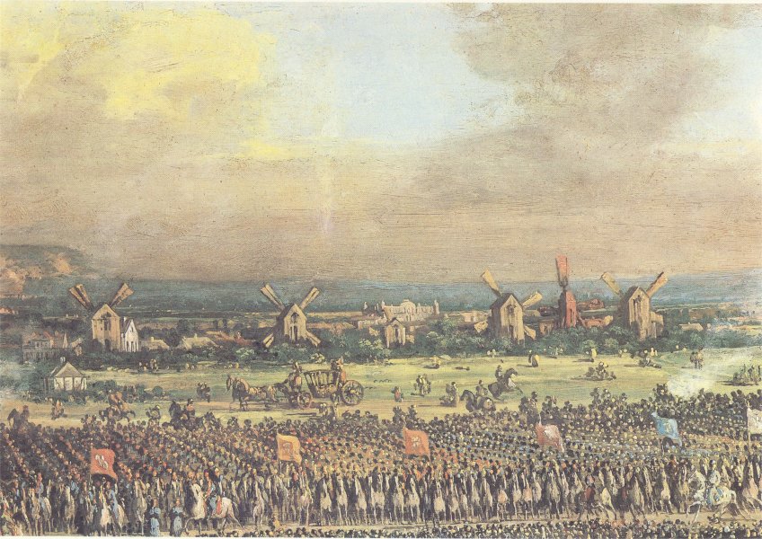
Since year 1575, Wola was known as site of Polish kings elections. 11 elections were held here (from 13 that were made in whole history of Poland), 10 kings and one queen were elected in Wola. Elections were significant events for the whole Europe, it was the first ever democratic system of choosing head of the country.
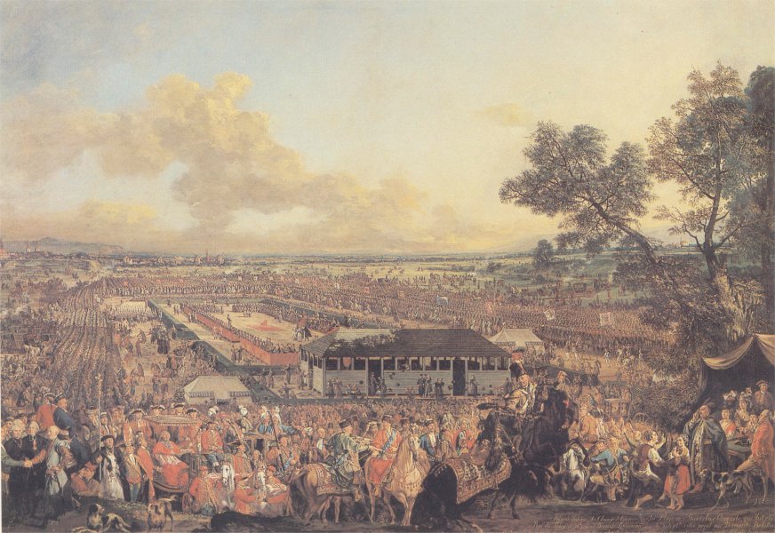
Election of the king, Wola 18th century (painting by Canalleto)
Further development of Wola occured in seventeenth century after changing capitol of Poland from Cracow to Warsaw. Soon around the Wola new villages were built, as well as jurydyki (plural for jurydyka) which were private villages or towns that were independent from the municipal laws and rulers but instead remained under the jurisdiction (hence the name) of the ecclesiastic or secular lord who chartered, founded and owned it. After some time also townsmen became owners of folwarks (german Vorwerk in polish folwark name for the giant farms). Routes that previously were borders between villages soon became trade routes and town streets.
Unfortunately, due to its placement Wola was often threatened by wars, and foreign attacks. In the middle of the seventeenth century, "Swedish deluge" caused a lot of damage, including destruction of most of the village buildings, along with wooden church.
In 1770 by the order of marshal Stanislaw Lubomirski, Warsaw was surrounded by embankment (called Lubomirski embankment), its purpose was to defend the city from bubonic plague. On the most important trade routes tollgates were built. In Wola embankment was built on current Okopowa and Towarowa street, and tollgate was situated on current crossroad of Towarowa and Chlodna street. Unfortunately buildings of tollgates in Wola did not survive to our times.
Wola tollgate
In the end of eighteenth century, along the embankment new Wola cemeteries were built: Powazki, Lutheran Cemetery, Calvinistic Cemetery, and Jewish one.
Due to lower prices of the grounds outside the embankment, not only houses were built but also workshops, and small factories. After some time also mansions and residences were built, and Wola itself became a Warsaw leisure district. Where events such as picnics and festivals took place.
In 1794, in the western tollgate an entrenchment was built, it played significant role during the Kosciuszko insurrection. In 1831, new entrenchments and redoubts were constructed. During the November Uprising redoubt number 56 played key role, it was placed near current Orthodox cemetery and church.
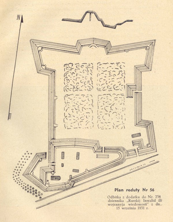
Plan of Redoubt number 56
Redoubt number 56, before the Russian attack in 1831.
Redoubt defence was commanded by gen. Sowinski,and the attacking Russian forces by gen. Paskiewicz. During the fights gen. Sowinski has died, and Wola was completely destroyed.
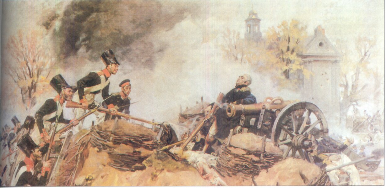
death of gen. Jozef Sowinski during the fights over Redoubt 56 (painting by Wojciech Kossak)
Since the end of eighteenth century redevelopment started in Wola, as a result district was called Wola Suburbs. New agricultural and food industry (distilleries, breweries and windmills) started to develop on Wola, as well as brickyards.
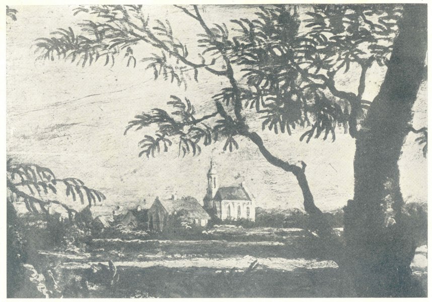
Wola windmills (painting by Canaletto)
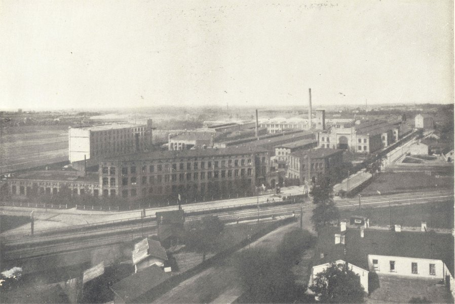
As a result industrial suburb of Warsaw was created. In the middle of nineteenth century after building Warsaw-Vienna Railroad, also metal, tanning and textile industry found its place in Wola. During that time Lubomirski embankment was dismantled and flatten, as a result the border between the city and suburbs was no more.
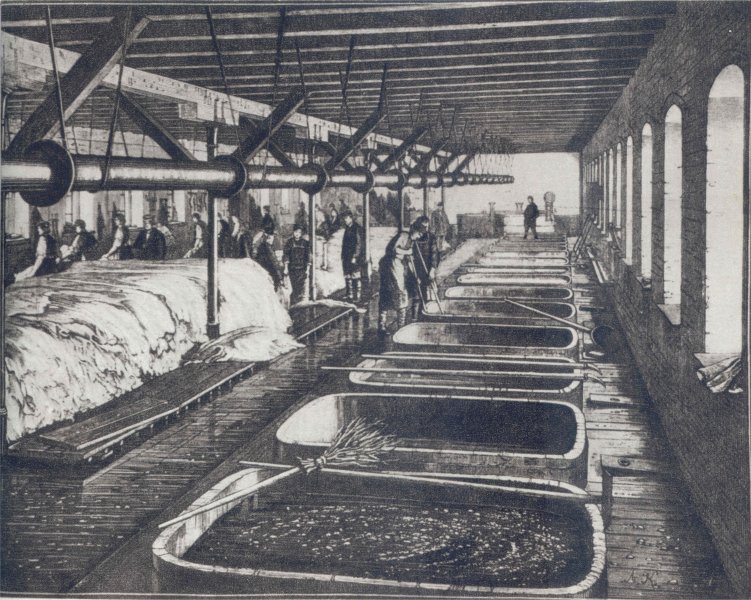
Tamler's Tannery
Population of Wola started to increase rapidly, and economic factors were the ones responsible for Wola's specific character. It became industrial district, with mostly wooden housing, and few tenement houses, which were not fitted with sewerage system.
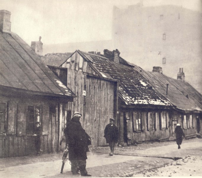
Street in Wola
Fields and gardens placed along Gorczewska street, and to the west of the circumference railroad (branch of the main railroad going along Bema street, after Powazki Cemetery turning to Warsaw Citadel) were used for growing fruits and vegetables.
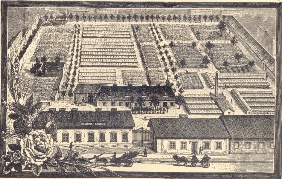
Ulrich's Horticultural Company
That made Wola a food supply for Warsaw. Goods growned or made in Wola were sold in Kercelak market, near former tollgate on corner of Gorczewska and Okopowa street.
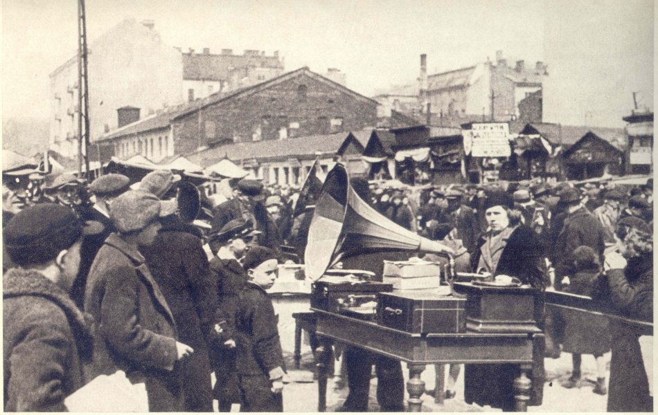
Kercelak
Population of Wola was stil growing rapidly. Near the end of nineteenth century Wola was inhabited by 28 000 people, and in the 1916 over 61 500. Wola was a conglomerate of nationalities and religions. Poles, Germans, Russians, Jews, and descendants of Georgians, Tatars and Dutchmen were living in good relationships.
Due to the First World War, Wola's development again was threatened. When Russians were withdrawing from Warsaw they were taking equipment and fittings from plants as well as workers with them deep into Russia.
In 1916 Wola became part of Warsaw. During the period between two World Wars heavy industry developed in Wola. A total number of 169 plants and factories were situated in Wola including: Zaklady Mechaniczne Lilpop, Rau and Loewenstein (Mechanical Works Lilpop, Rau and Loewenstein),
Mechanical Works Lilpop, Rau and Loewenstein.
Mechanical Works Gerlach, Rifle Production Plant of National Arms Factory, Warsaw Joint-Stock Company Producing Locomotives, Light Bulbs and Radio Factory Philips, Franaszek Paper Upholster Factory,
Franaszek Paper Upholster Factory
Gramophone Records Factory on Plocka street 13, Chemical Products Factory "Dobrolin", Hennenberg Silver Plate Factory,
Hennenberg Silver Plate Factory
Fittings and Motorcycle Factory "Ursus", Norblin's Factory, gasworks and power plant for city trams.
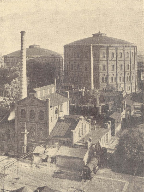
Gasworks in Wola
Biggest factories employed circa 20 000 workers.
Handicraft and small business was also placed in Wola in great numbers, the most important ones were: Ordowski Brothers Car Body Workshop on st. Wolska 111 and Borkowski Brothers Car Workshop (General Motors and Chevrolet car bodies). In 1939 Borkowski Brothers Car Workshop, supplied Polish Army for free with trucks which were used for transporting ammunition.
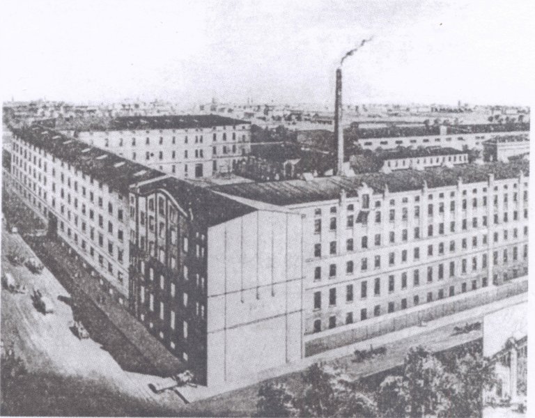
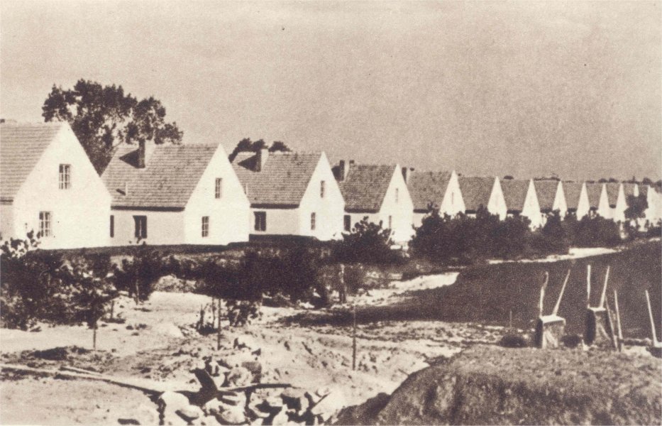
Due to the specification of district, living conditions were bad and flats and houses were overpopulated. There were few social initiatives, one of them however was colony of cheap houses and blocks for workers built by Wawelberg Foundation on Gorczewska and Ludwiki street.
Housing estate of H. and L. Wawelberg Cheap Housing Foundation
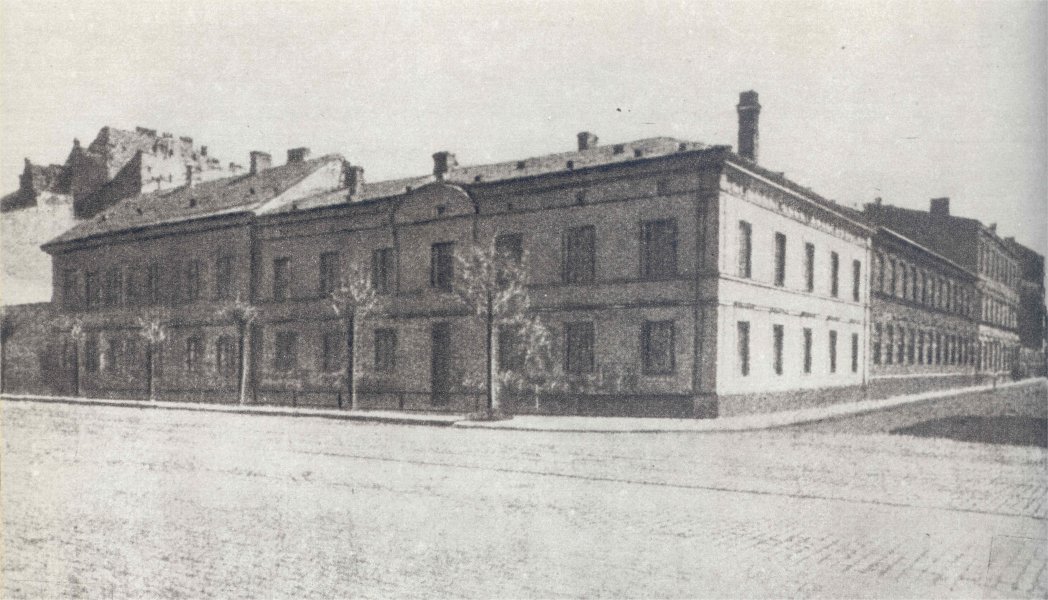
Economic upturn in 1930's, brought new real estate investments mostly in Kolo.
Single houses in Kolo
Five hospitals and many schools (some of them really modern) were built in Wola as well.
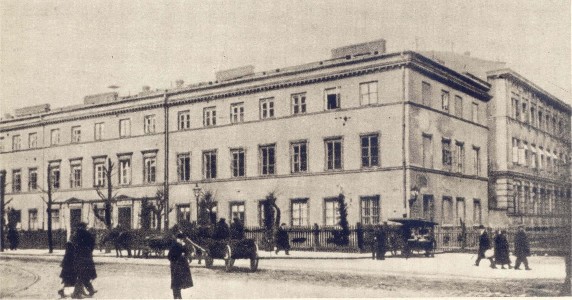
Wola's Hospital
School on Bema street, is still one of the most beautiful in Warsaw.
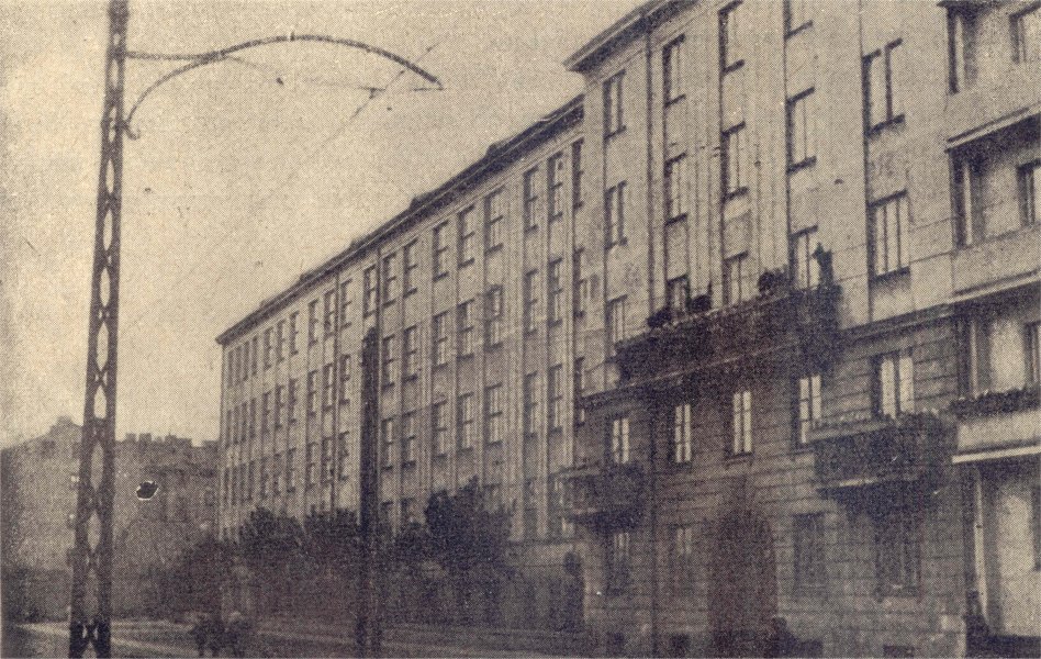
School on st. Bema 76
Administrative structure of district before 1945 was completely different from the current one. By the name Wola was known area bordered by Okopowa and Towarowa street on east, railroad and ave. Jerozolimskie on south, Budziszynska, Bodzanty street, Wola Cemetery and Priest Janusz street on west. On the north Wola was bordered by railroad near Tatarska and Powazkowska street, just outside the Powazki Cemetery.
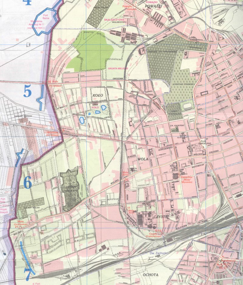
Pre-war map of Wola
In 1938 population of Wola was 84 424 people. And in the end of 1945, only 19.964 people lived Wola, that is near 24% of pre-war population.
1 September of 1939, was the end of an epoch in history for Poland, Warsaw and its district - Wola.
compiled by::
Maciej Janaszek-Seydlitz
Jerzy Janowski
Janina Mańkowska
translation: Kamil Kornatka
Copyright © 2010 SPPW1944. All rights reserved.